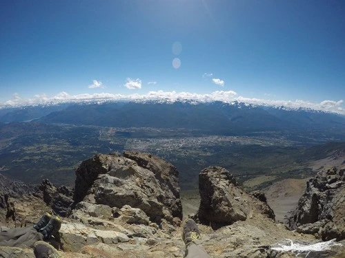
El Bolsón e seu vizinho Cerro Piltriquitron são locais imperdíveis na província de Río Negro, na Argentina. El Bolsón é conhecido por sua vibrante cultura artesanal, aventuras nas montanhas e vistas espetaculares dos lagos e florestas da Patagônia. Os visitantes podem explorar as feiras de artesanato e o colorido centro da cidade, passear ao redor do lago ou participar de algumas das desafiadoras atividades ao ar livre, como rafting, passeios a cavalo e mountain bike. O Cerro Piltriquitron é uma sentinela que vigia a área, com seu cume de quase 5.000 metros; caminhantes e montanhistas podem assumir o desafio de chegar ao cume e apreciar algumas das vistas mais deslumbrantes da região. Os fotógrafos poderão capturar pores do sol incríveis, panoramas de montanhas e a atmosfera vibrante da cidade de El Bolsón desde o cume.
🗺 Mapa
🎫 Atrações turísticas
🌦 Informações meteorológicas
Obtenha informações meteorológicas e muito mais, pelo app. Baixe grátis!
🚕 Como chegar?
Obtenha informações de rotas (de carro, a pé, transporte público, etc) e muito mais, pelo app. Baixe grátis!