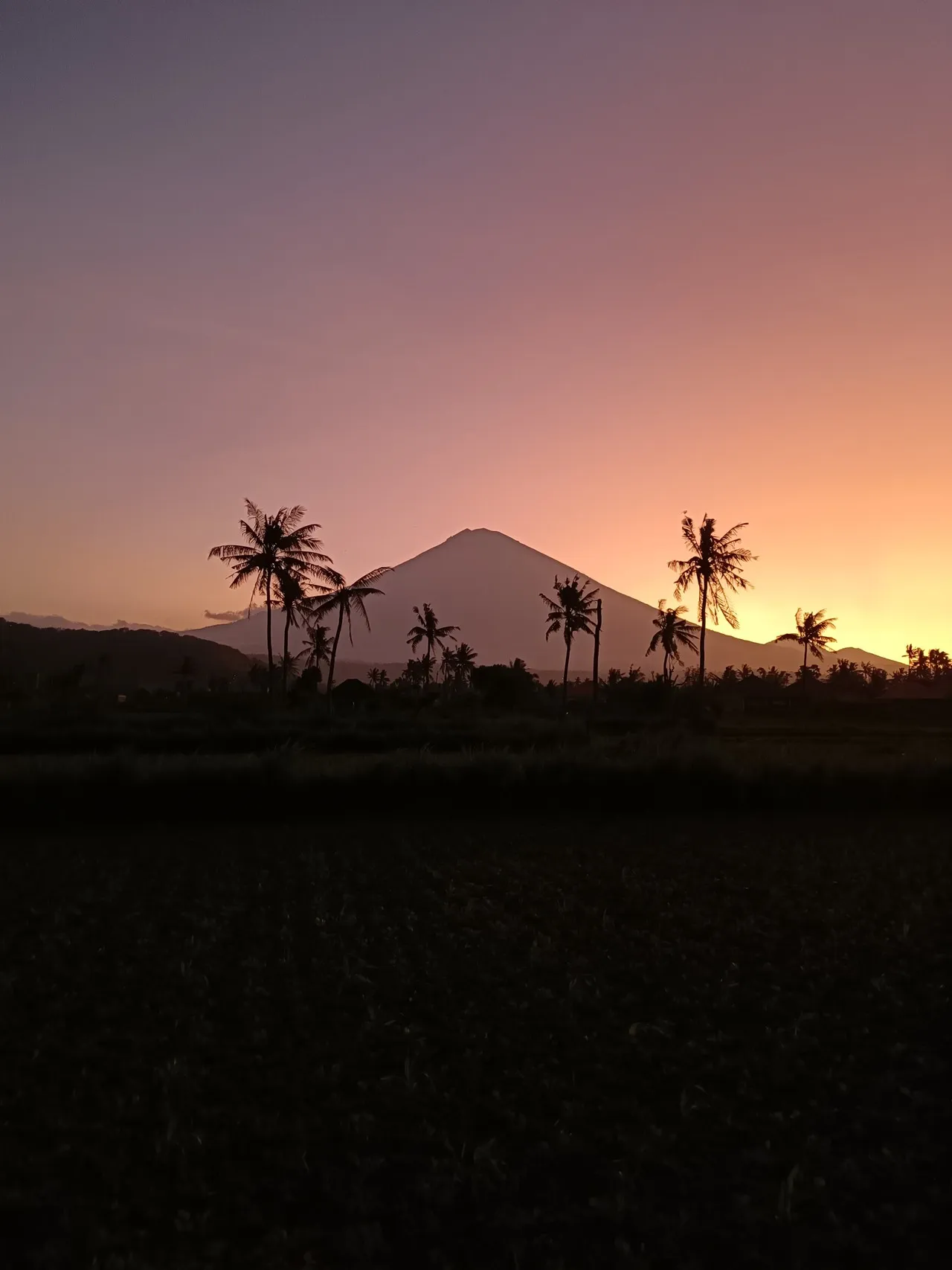
발리네즈로는 Gunung Agung 또는 Mount Agung이라 불리는 이 산은 인도네시아 발리 섬에서 가장 높은 봉우리입니다. 높이 3,031미터의 활화산이며 발리 힌두교도들에게 가장 신성한 산으로 여겨집니다.
Mount Agung 등반은 여행객들에게 인기 있는 활동으로, 안전상의 이유로 가이드를 동반하는 것이 좋습니다. 등반 시간은 약 4-5시간 정도 소요되며, 주변 경관과 분화구의 멋진 전경을 감상할 수 있습니다. 등반하기 가장 좋은 시기는 4월부터 9월까지 건기에 해당됩니다. 등반의 출발점은 섬에서 가장 큰 힌두 사원인 Pura Besakih입니다. 일출을 맞이하기 위해 정상에 도착할 수 있도록 밤에 등반을 시작하는 것이 좋으며, 그 장관은 말로 표현할 수 없이 아름답습니다. 단, 정상에서는 기온이 낮으므로 대비가 필요합니다. 등반 외에도 Mount Agung에서는 Besakih 사원을 방문하는 것이 인기가 높습니다. 이 고대 사원 단지는 발리 힌두교도들에게 가장 신성하고 중요한 사원이며, 23개의 사원으로 이루어져 있어 Mount Agung과 주변 논밭의 멋진 전경을 감상할 수 있습니다. 사진 작가들에게 Mount Agung은 멋진 경관과 문화적 의미가 어우러진 꿈의 목적지와도 같습니다. 최고의 사진 촬영 장소는 일출이나 일몰을 담을 수 있는 정상과 Pura Besakih입니다. 활성 상태인 바람에 최근 몇 년 동안 Mount Agung에서 분출이 있어 여행 계획에 차질을 빚거나 등반로가 임시로 폐쇄된 경우가 있으므로, 여행 계획 전 현지 당국에 확인하는 것이 중요합니다. 결론적으로, Mount Agung은 여행객과 사진 작가 모두에게 독특하고 보람 있는 경험을 제공합니다. 등반을 하든 멀리서 그 장관을 감상하든, 발리에 방문한다면 이 상징적인 랜드마크는 반드시 들러야 할 곳입니다. 단, 여행 계획을 신중히 세우고 이 신성한 산이 지닌 문화적 의미를 존중해야 합니다.
Mount Agung 등반은 여행객들에게 인기 있는 활동으로, 안전상의 이유로 가이드를 동반하는 것이 좋습니다. 등반 시간은 약 4-5시간 정도 소요되며, 주변 경관과 분화구의 멋진 전경을 감상할 수 있습니다. 등반하기 가장 좋은 시기는 4월부터 9월까지 건기에 해당됩니다. 등반의 출발점은 섬에서 가장 큰 힌두 사원인 Pura Besakih입니다. 일출을 맞이하기 위해 정상에 도착할 수 있도록 밤에 등반을 시작하는 것이 좋으며, 그 장관은 말로 표현할 수 없이 아름답습니다. 단, 정상에서는 기온이 낮으므로 대비가 필요합니다. 등반 외에도 Mount Agung에서는 Besakih 사원을 방문하는 것이 인기가 높습니다. 이 고대 사원 단지는 발리 힌두교도들에게 가장 신성하고 중요한 사원이며, 23개의 사원으로 이루어져 있어 Mount Agung과 주변 논밭의 멋진 전경을 감상할 수 있습니다. 사진 작가들에게 Mount Agung은 멋진 경관과 문화적 의미가 어우러진 꿈의 목적지와도 같습니다. 최고의 사진 촬영 장소는 일출이나 일몰을 담을 수 있는 정상과 Pura Besakih입니다. 활성 상태인 바람에 최근 몇 년 동안 Mount Agung에서 분출이 있어 여행 계획에 차질을 빚거나 등반로가 임시로 폐쇄된 경우가 있으므로, 여행 계획 전 현지 당국에 확인하는 것이 중요합니다. 결론적으로, Mount Agung은 여행객과 사진 작가 모두에게 독특하고 보람 있는 경험을 제공합니다. 등반을 하든 멀리서 그 장관을 감상하든, 발리에 방문한다면 이 상징적인 랜드마크는 반드시 들러야 할 곳입니다. 단, 여행 계획을 신중히 세우고 이 신성한 산이 지닌 문화적 의미를 존중해야 합니다.
TOP
🗺 지도
🎫 관광 명소
🌦 날씨 정보
앱에서 날씨 정보 등 다양한 정보를 확인하세요. 무료로 다운로드하세요!
🚕 어떻게 가나요?
앱에서 경로 정보(자동차, 도보, 대중교통 등) 등 다양한 정보를 확인하세요. 무료로 다운로드하세요!