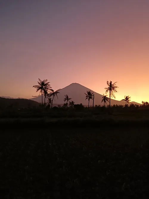
アグン山(バリ語ではガヌン・アグンとも呼ばれます)は、インドネシアのバリ島にある最高峰です。この活火山は高さ3,031メートルを誇り、バリのヒンドゥー教徒にとって最も神聖な山とされています。
アグン山の登山は旅行者に人気のアクティビティであり、安全のためにガイドを同行することが推奨されています。登山には約4~5時間かかり、周囲の風景や火口の驚くべき眺望を楽しむことができます。登山に最適な時期は、4月から9月の乾季です。 登山の出発地点は、島で最大のヒンドゥー寺院であるプラ・ベサキです。日の出を山頂から拝むために、夜間に登り始めることが推奨されており、息をのむような光景を楽しむことができます。ただし、山頂の厳しい寒さには十分ご注意ください。 登山以外にも、アグン山で人気のある活動はプラ・ベサキの訪問です。この古代寺院群はバリのヒンドゥー教徒にとって最も神聖で重要な寺院であり、23の寺院から構成されています。また、アグン山と周囲の田園風景の美しいパノラマビューを楽しむことができます。 写真家にとっても、アグン山は壮大な景観と文化的意義を兼ね備えた夢のような目的地です。写真撮影に最適なスポットは、日の出や日の入りを捉えられる山頂や、プラ・ベサキの周辺です。 なお、活発な火山であるため、近年アグン山から噴火が発生し、旅行計画に影響を与え、登山道が一時的に閉鎖されたことがあります。アグン山への旅行を計画する際には、必ず事前に地元当局に確認してください。 結論として、アグン山は旅行者と写真家の双方にユニークで充実した体験を提供します。登山して頂上まで達するにせよ、遠くからその雄大な姿を眺めるにせよ、この象徴的なランドマークはバリに訪れる際には必ず訪れるべき場所です。旅行の計画は十分に立て、この神聖な山の文化的意義を尊重するよう心がけてください。
アグン山の登山は旅行者に人気のアクティビティであり、安全のためにガイドを同行することが推奨されています。登山には約4~5時間かかり、周囲の風景や火口の驚くべき眺望を楽しむことができます。登山に最適な時期は、4月から9月の乾季です。 登山の出発地点は、島で最大のヒンドゥー寺院であるプラ・ベサキです。日の出を山頂から拝むために、夜間に登り始めることが推奨されており、息をのむような光景を楽しむことができます。ただし、山頂の厳しい寒さには十分ご注意ください。 登山以外にも、アグン山で人気のある活動はプラ・ベサキの訪問です。この古代寺院群はバリのヒンドゥー教徒にとって最も神聖で重要な寺院であり、23の寺院から構成されています。また、アグン山と周囲の田園風景の美しいパノラマビューを楽しむことができます。 写真家にとっても、アグン山は壮大な景観と文化的意義を兼ね備えた夢のような目的地です。写真撮影に最適なスポットは、日の出や日の入りを捉えられる山頂や、プラ・ベサキの周辺です。 なお、活発な火山であるため、近年アグン山から噴火が発生し、旅行計画に影響を与え、登山道が一時的に閉鎖されたことがあります。アグン山への旅行を計画する際には、必ず事前に地元当局に確認してください。 結論として、アグン山は旅行者と写真家の双方にユニークで充実した体験を提供します。登山して頂上まで達するにせよ、遠くからその雄大な姿を眺めるにせよ、この象徴的なランドマークはバリに訪れる際には必ず訪れるべき場所です。旅行の計画は十分に立て、この神聖な山の文化的意義を尊重するよう心がけてください。
TOP
🗺 地図
🎫 観光名所
🌦 天気情報
天気情報などをアプリから取得しましょう。無料でダウンロード!
🚕 どうやって行く?
ルート情報(車、徒歩、公共交通機関など)などをアプリから取得しましょう。無料でダウンロード!