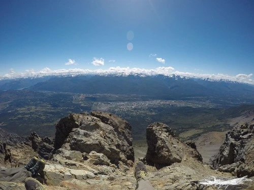
El Bolsón e il vicino Cerro Piltriquitron sono siti imperdibili nella provincia argentina del Río Negro. El Bolsón è noto per la sua vivace cultura artigianale, le avventure in montagna e le viste spettacolari sui laghi e sulle foreste della Patagonia. I visitatori possono esplorare le fiere dell'artigianato e il colorato centro, passeggiare intorno al lago o dedicarsi ad alcune delle impegnative attività all'aperto come rafting, equitazione e mountain bike. Il Cerro Piltriquitron è una sentinella che vigila sulla zona, con la sua vetta che sfiora i 5000 metri; gli escursionisti e gli alpinisti possono accettare la sfida di scalarlo e ammirare alcuni dei panorami più mozzafiato della regione. I fotografi potranno catturare tramonti incredibili, panorami dei crinali montuosi e la vibrante atmosfera della città di El Bolsón dalla vetta.
🗺 Mappa
🎫 Attrazioni turistiche
🌦 Informazioni meteo
Ottieni informazioni meteo, e molto altro, dall'app. Scaricala gratuitamente!
🚕 Come arrivarci?
Ottieni informazioni sui percorsi (in auto, a piedi, trasporto pubblico, ecc.), e molto altro, dall'app. Scaricala gratuitamente!