U
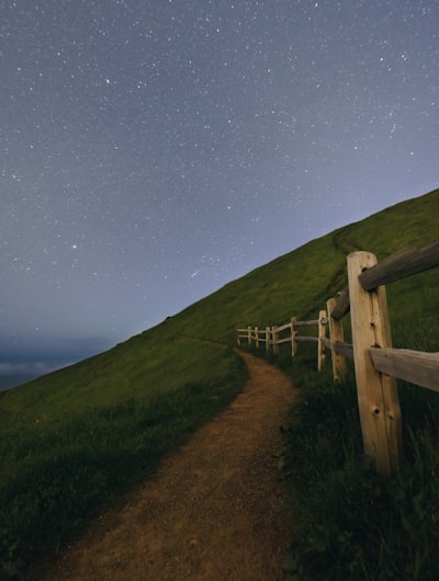
@levibare1 - UnsplashMount Tamalpais
📍 Frá Trojan Point, United States
Mount Tamalpais er táknræður tindur í Mount Tamalpais ríkisgarði Marin County. Tindi hennar, East Peak, er hæsta punkturinn í sveitarfélaginu. Mount Tamalpais býður upp á villta landslagi umkrunta afar borgarumhverfi: Útsýnið nær frá rólegum ströndum til hrjúfra fjallskamla og veitir nokkur af glæsilegustu útsýnum Kaliforníu. Svæðið er vinsælt til dagsferðalengdra göngus, með mörgum stígum og nokkrum vinsælum stöðum eins og Stinson Beach, Muir Woods og Tomales Bay. Þar finnst einnig fjölbreytt dýralíf, plöntur og lífríki. Af tindinum má í fjarska sjá sjónarmið San Francisco. Í garðinum eru fjölmargir kostir fyrir tjaldbúðamennsku, píkník og skoðunarferðir.
Ef þú ert að leita að einstökum stað til að taka mynd, getur þú ekki borið saman við öndunarvaldandi útsýnið frá tindinum á Mount Tamalpais. Með hrollandi hæðum, löngum sléttu og skógum í bakgrunni munt þú örugglega ná einstökum skotti. Eitt vinsælustu sjónarmiðin er frá útsýnisstaðnum við Pantoll-stöðina.
Ef þú ert að leita að einstökum stað til að taka mynd, getur þú ekki borið saman við öndunarvaldandi útsýnið frá tindinum á Mount Tamalpais. Með hrollandi hæðum, löngum sléttu og skógum í bakgrunni munt þú örugglega ná einstökum skotti. Eitt vinsælustu sjónarmiðin er frá útsýnisstaðnum við Pantoll-stöðina.
🗺 Kort
🎫 Ferðamannastaðir
🌦 Veðurupplýsingar
Fáðu veðurupplýsingar, og margt fleira, frá appinu. Sæktu það frítt!
🚕 Hvernig á að komast þangað?
Fáðu leiðarupplýsingar (með bíl, gangandi, almenningssamgöngum, o.s.frv.), og margt fleira, frá appinu. Sæktu það frítt!