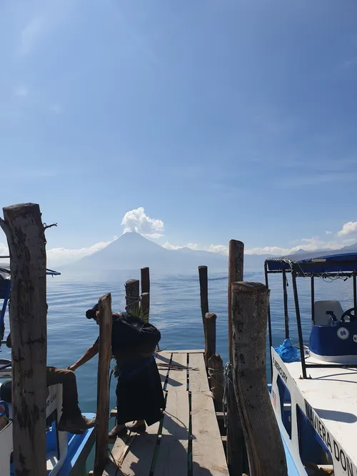
Volcán San Pedro, situé dans la ville de Panajachel au Guatemala, est une destination incontournable pour les voyageurs et les photographes. Ce volcan magnifique fait partie de la chaîne de montagnes Sierra Madre de Chiapas et s'élève à une hauteur impressionnante de 9 908 pieds.
L'une des meilleures façons de découvrir le Volcán San Pedro est de le faire en randonnée. La montée jusqu'au sommet prend environ 5 à 6 heures et n'est pas pour les âmes sensibles. Cependant, les vues panoramiques depuis le sommet valent bien l'effort. En chemin, vous rencontrerez également une flore et une faune diversifiées, ce qui en fait un endroit idéal pour la photographie de la nature. Pour ceux qui préfèrent une expérience plus détendue, il existe également des excursions en bateau qui offrent des vues du volcan depuis les eaux sereines du lac Atitlán. Vous pouvez également choisir d'explorer les villages environnants et d'en apprendre davantage sur la culture et les traditions mayas locales. Panajachel, la ville la plus proche du Volcán San Pedro, est un centre animé avec une variété de magasins, de restaurants et d'hébergements. C'est l'endroit idéal pour faire le plein de provisions avant de commencer votre randonnée. La ville offre également de belles vues sur le volcan, en faisant un lieu populaire pour les photographes. Cependant, il est important de noter que le Volcán San Pedro est un volcan actif, il est donc toujours préférable de vérifier auprès des autorités locales avant de planifier votre voyage. De plus, selon la période de l'année, le volcan peut être entouré d'un brouillard dense, alors préparez-vous à une visibilité limitée. En bref, si vous cherchez une destination riche en aventure avec des vues à couper le souffle et des opportunités pour réaliser de superbes photographies, alors le Volcán San Pedro à Panajachel, Guatemala, devrait être en haut de votre liste. N'oubliez pas d'emporter vos chaussures de randonnée et votre appareil photo avant de vous rendre à ce volcan magnifique.
L'une des meilleures façons de découvrir le Volcán San Pedro est de le faire en randonnée. La montée jusqu'au sommet prend environ 5 à 6 heures et n'est pas pour les âmes sensibles. Cependant, les vues panoramiques depuis le sommet valent bien l'effort. En chemin, vous rencontrerez également une flore et une faune diversifiées, ce qui en fait un endroit idéal pour la photographie de la nature. Pour ceux qui préfèrent une expérience plus détendue, il existe également des excursions en bateau qui offrent des vues du volcan depuis les eaux sereines du lac Atitlán. Vous pouvez également choisir d'explorer les villages environnants et d'en apprendre davantage sur la culture et les traditions mayas locales. Panajachel, la ville la plus proche du Volcán San Pedro, est un centre animé avec une variété de magasins, de restaurants et d'hébergements. C'est l'endroit idéal pour faire le plein de provisions avant de commencer votre randonnée. La ville offre également de belles vues sur le volcan, en faisant un lieu populaire pour les photographes. Cependant, il est important de noter que le Volcán San Pedro est un volcan actif, il est donc toujours préférable de vérifier auprès des autorités locales avant de planifier votre voyage. De plus, selon la période de l'année, le volcan peut être entouré d'un brouillard dense, alors préparez-vous à une visibilité limitée. En bref, si vous cherchez une destination riche en aventure avec des vues à couper le souffle et des opportunités pour réaliser de superbes photographies, alors le Volcán San Pedro à Panajachel, Guatemala, devrait être en haut de votre liste. N'oubliez pas d'emporter vos chaussures de randonnée et votre appareil photo avant de vous rendre à ce volcan magnifique.
🗺 Carte
🎫 Attractions touristiques
🌦 Informations météorologiques
Obtenez des informations météorologiques, et bien plus encore, depuis l'application. Téléchargez-la gratuitement !
🚕 Comment y arriver ?
Obtenez des informations sur les itinéraires (en voiture, à pied, en transports en commun, etc.), et bien plus encore, depuis l'application. Téléchargez-la gratuitement !