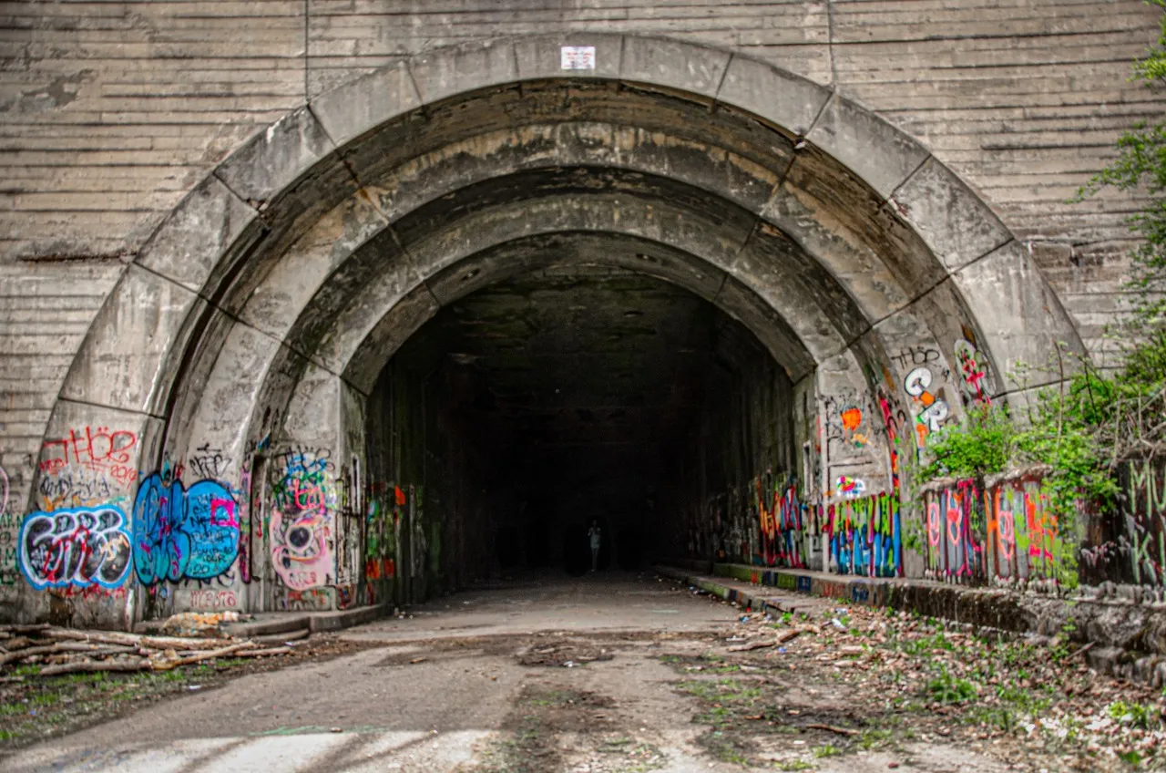
Sideling Hill Tunnel, located near Fort Littleton, Pennsylvania, is a fascinating relic of mid-20th-century transportation history. Part of the Pennsylvania Turnpike, the tunnel was one of seven original tunnels constructed in the 1930s, designed to cut through the Appalachian Mountains and significantly reduce travel time across the state. The tunnel's construction was a massive engineering feat at the time, involving the boring of a 6,782-foot passage through Sideling Hill, a formidable geological barrier.
Sideling Hill Tunnel operated from 1940 until 1968, when it was bypassed due to traffic congestion and safety concerns. The Pennsylvania Turnpike Commission decided to abandon this and two other tunnels in favor of a more modern, four-lane highway. Today, the tunnel is part of the Abandoned Pennsylvania Turnpike, a stretch of road that has become a popular destination for hikers, bikers, and history enthusiasts. The eerie, graffiti-covered tunnel, surrounded by dense forest, offers a unique experience for those interested in exploring forgotten infrastructure. Access is free, but visitors should bring flashlights as there is no artificial lighting. This site offers an intriguing glimpse into the evolution of American highway systems and the challenges of early interstate travel.
Sideling Hill Tunnel operated from 1940 until 1968, when it was bypassed due to traffic congestion and safety concerns. The Pennsylvania Turnpike Commission decided to abandon this and two other tunnels in favor of a more modern, four-lane highway. Today, the tunnel is part of the Abandoned Pennsylvania Turnpike, a stretch of road that has become a popular destination for hikers, bikers, and history enthusiasts. The eerie, graffiti-covered tunnel, surrounded by dense forest, offers a unique experience for those interested in exploring forgotten infrastructure. Access is free, but visitors should bring flashlights as there is no artificial lighting. This site offers an intriguing glimpse into the evolution of American highway systems and the challenges of early interstate travel.
TOP
🗺 Map
Want to see more? Download the app. It's free!
- Weather informationCheck the forecast, clouds, rain, visibility, temperature, and wind before you go. Download it for free!
- How to get there?Choose how to get there by car, walking, or public transport from your location. Download it for free!
- CollectionsSave this spot in lists for future trips.
- Visited PlacesMark places you have visited and see them together on one map.
- Favourite RegionsGet alerts when new spots are added in your favourite regions.
- Offline mapsDownload maps before a trip for places with weak connection.
- Upload your photosUpload your photos and help other travelers find good photo spots.
- Audio guidesCreate narrated guides to listen to while you visit a place.