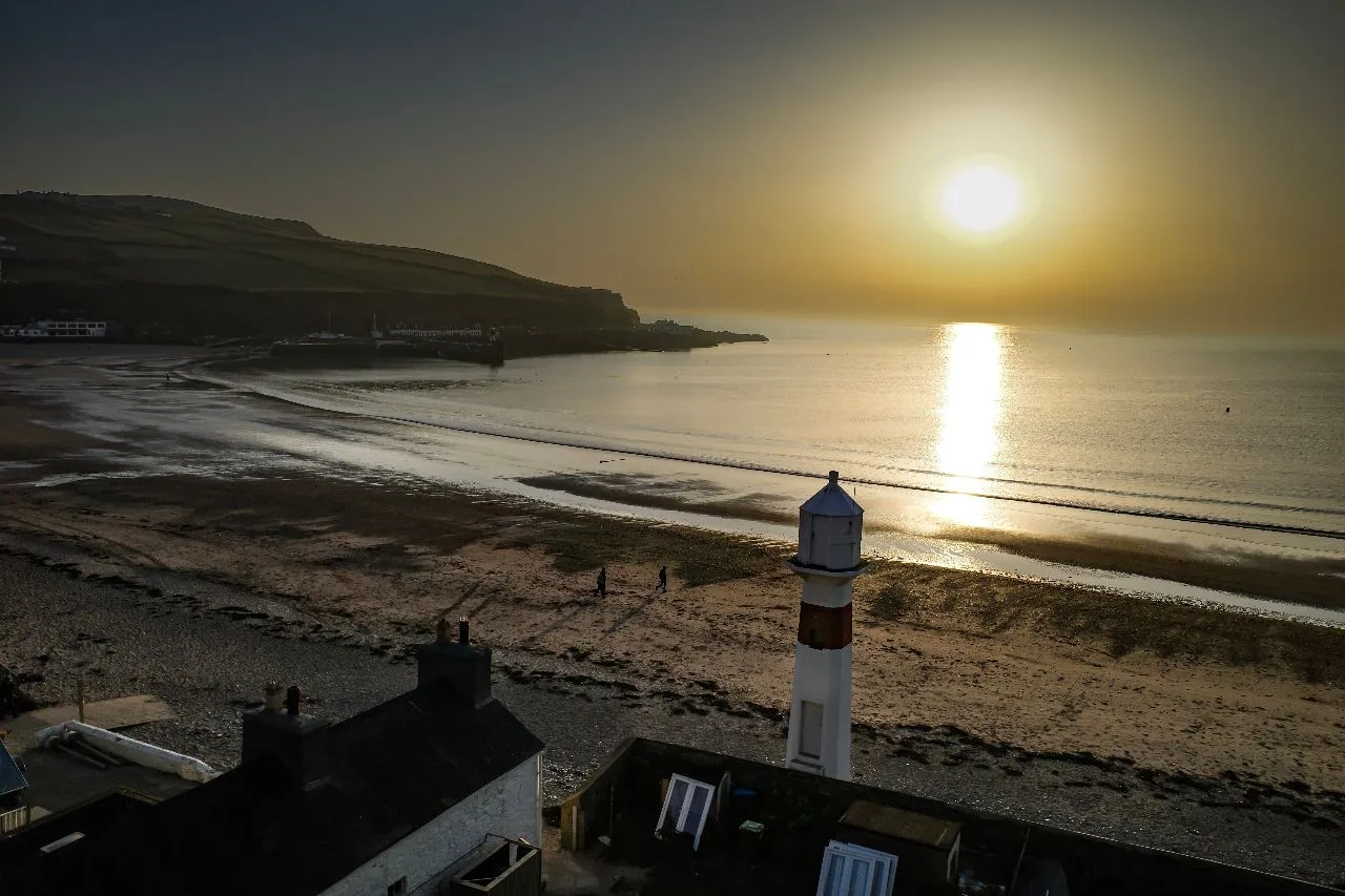
Port Erin Bay is a lovely coastal stretch in Port Erin, Isle of Man. Situated on the western end of the island, it is an ideal spot for a day-trip escape. One can enjoy beautiful sunrises, the green countryside, and the sound of rolling waves.
The bay offers an array of activities, including walking, fishing, swimming, sailing and kayaking. Visible on either side of the bay are famous landmarks; the Marine Drive on the west side, and Port Erin Railway Station on the east side. You can also spot the small town of Port St. Mary situated to the southeast. In addition, the Port Erin Beach is a great spot to relax near the beach and watch the tidal movements. For adventure lovers, there are lots of cliff faces and grassy slopes for mountain biking and exploring nature. The scenery here is bound to take your breath away with its unspoiled natural beauty. The bay is an ideal destination for birdwatchers, being close to the Marine Nature Reserve and the Bradda Head Nature Reserve. Whether you are an enthusiastic walker or simply someone who loves the outdoors, a trip to Port Erin Bay is a must for every traveler and photographer!
The bay offers an array of activities, including walking, fishing, swimming, sailing and kayaking. Visible on either side of the bay are famous landmarks; the Marine Drive on the west side, and Port Erin Railway Station on the east side. You can also spot the small town of Port St. Mary situated to the southeast. In addition, the Port Erin Beach is a great spot to relax near the beach and watch the tidal movements. For adventure lovers, there are lots of cliff faces and grassy slopes for mountain biking and exploring nature. The scenery here is bound to take your breath away with its unspoiled natural beauty. The bay is an ideal destination for birdwatchers, being close to the Marine Nature Reserve and the Bradda Head Nature Reserve. Whether you are an enthusiastic walker or simply someone who loves the outdoors, a trip to Port Erin Bay is a must for every traveler and photographer!
🗺 Map
🎫 Tourist attractions
🌦 Weather information
Get weather information, and much more, from the app. Download it for free!
🚕 How to get there?
Get routes information (by car, walking, public transport, etc), and much more, from the app. Download it for free!