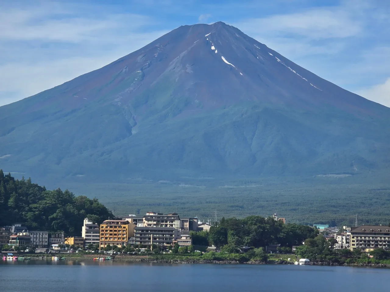
Mount Fuji is Japan’s iconic stratovolcano (3,776 m), dominating the skyline above Fujikawaguchiko and the Fuji Five Lakes. It’s important both as the country’s highest peak and a potent cultural symbol—subject of pilgrimage, Shinto devotion (notably at Sengen shrines), and countless works of art such as Hokusai’s Thirty-six Views. Geologically a composite cone, its symmetrical profile conceals a cratered summit formed by repeated eruptions; the last major event was the Hōei eruption of 1707, which deposited ash across Edo (Tokyo).
In Fujikawaguchiko the mountain is experienced visually and ritually: lakes like Kawaguchi mirror its slopes, and the town serves as a base for the Yoshida Trail, the most popular ascent route beginning near the Kawaguchiko 5th Station. Seasonal climbing rules and mountain-hut systems are enforced—official summer climbing season (typically July–August) opens routes and services; outside that window many trails, huts, and rescue provisions are closed. Unique local offerings include sunrise-viewing (goraikō) from the summit or lakeshore, seasonal festivals tied to floral displays such as shibazakura fields, and viewpoints aligned with traditional framed vistas that emphasize Fuji’s sacred geometry within the landscape.
In Fujikawaguchiko the mountain is experienced visually and ritually: lakes like Kawaguchi mirror its slopes, and the town serves as a base for the Yoshida Trail, the most popular ascent route beginning near the Kawaguchiko 5th Station. Seasonal climbing rules and mountain-hut systems are enforced—official summer climbing season (typically July–August) opens routes and services; outside that window many trails, huts, and rescue provisions are closed. Unique local offerings include sunrise-viewing (goraikō) from the summit or lakeshore, seasonal festivals tied to floral displays such as shibazakura fields, and viewpoints aligned with traditional framed vistas that emphasize Fuji’s sacred geometry within the landscape.
TOP
🗺 Map
Want to see more? Download the app. It's free!
- Weather informationCheck the forecast, clouds, rain, visibility, temperature, and wind before you go. Download it for free!
- How to get there?Choose how to get there by car, walking, or public transport from your location. Download it for free!
- CollectionsSave this spot in lists for future trips.
- Visited PlacesMark places you have visited and see them together on one map.
- Favourite RegionsGet alerts when new spots are added in your favourite regions.
- Offline mapsDownload maps before a trip for places with weak connection.
- Upload your photosUpload your photos and help other travelers find good photo spots.
- Audio guidesCreate narrated guides to listen to while you visit a place.