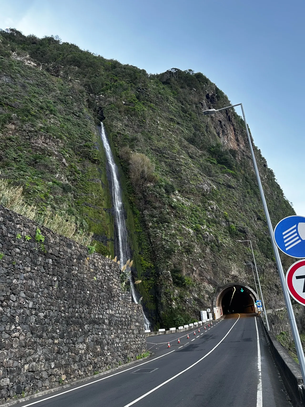
Miradouro Água d'Alto is a cliff-top viewpoint on the north coast of São Vicente (Madeira) that frames a dramatic meeting of basalt cliffs, terraced slopes and the Atlantic swell. Important as a vantage for the island’s volcanic coastline, it offers sweeping panoramas over a small cove, rocky promontories and the open sea—excellent for sunrise, cloud-inversion vistas and watching waves carve the shore. The site’s visual character is shaped by dark volcanic rock, former agricultural terraces and scattered laurisilva remnants; these geology-and-vegetation contrasts explain much of its appeal.
Historically, vantage points like Água d'Alto played pragmatic roles for coastal communities—fishermen, lookouts and informal whale-spotters—so the miradouro is as much a cultural landmark as a scenic one. The viewing platform itself is typically simple: stone-paved terrace, low walls or railings and interpretive panels pointing out notable features and local toponyms rather than grand architecture. Unique local curiosities include frequent wind-sculpted cloud bands and sudden light changes that make short visits highly variable; birdwatchers may spot seabirds riding the thermals. The miradouro connects to nearby footpaths and rural lanes, making it a compact stop that encapsulates São Vicente’s raw coastal geology and maritime heritage.
Historically, vantage points like Água d'Alto played pragmatic roles for coastal communities—fishermen, lookouts and informal whale-spotters—so the miradouro is as much a cultural landmark as a scenic one. The viewing platform itself is typically simple: stone-paved terrace, low walls or railings and interpretive panels pointing out notable features and local toponyms rather than grand architecture. Unique local curiosities include frequent wind-sculpted cloud bands and sudden light changes that make short visits highly variable; birdwatchers may spot seabirds riding the thermals. The miradouro connects to nearby footpaths and rural lanes, making it a compact stop that encapsulates São Vicente’s raw coastal geology and maritime heritage.
🗺 Map
Want to see more? Download the app. It's free!
- Weather informationCheck the forecast, clouds, rain, visibility, temperature, and wind before you go. Download it for free!
- How to get there?Choose how to get there by car, walking, or public transport from your location. Download it for free!
- CollectionsSave this spot in lists for future trips.
- Visited PlacesMark places you have visited and see them together on one map.
- Favourite RegionsGet alerts when new spots are added in your favourite regions.
- Offline mapsDownload maps before a trip for places with weak connection.
- Upload your photosUpload your photos and help other travelers find good photo spots.
- Audio guidesCreate narrated guides to listen to while you visit a place.