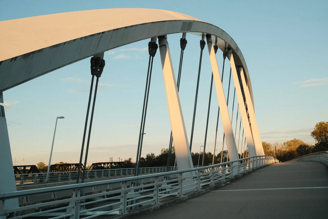
The Main Street Bridge in Columbus, Ohio, is a striking piece of modern engineering and a key landmark in the city. Spanning the Scioto River, this bridge is notable for its distinctive design, featuring a unique inclined arch that supports the bridge deck. Designed by renowned architect Dr. Spiro Pollalis and completed in 2010, it was the first inclined arch bridge in North America, highlighting Columbus's commitment to innovative infrastructure.
The bridge is 700 feet long and 64 feet wide, with a three-lane roadway and a separate pedestrian walkway that offers stunning views of the downtown Columbus skyline and the Scioto Mile, a popular urban parkland along the river. Its sleek, white steel structure not only serves as a critical transportation link but also as an aesthetic focal point for the area, especially when illuminated at night. The Main Street Bridge is part of a broader revitalization effort in the city, contributing to the enhancement of urban connectivity and public space. Visitors often enjoy walking or cycling across the bridge, especially during events like the Columbus Arts Festival, which takes place nearby, making it a vibrant part of the community.
The bridge is 700 feet long and 64 feet wide, with a three-lane roadway and a separate pedestrian walkway that offers stunning views of the downtown Columbus skyline and the Scioto Mile, a popular urban parkland along the river. Its sleek, white steel structure not only serves as a critical transportation link but also as an aesthetic focal point for the area, especially when illuminated at night. The Main Street Bridge is part of a broader revitalization effort in the city, contributing to the enhancement of urban connectivity and public space. Visitors often enjoy walking or cycling across the bridge, especially during events like the Columbus Arts Festival, which takes place nearby, making it a vibrant part of the community.
🗺 Map
Want to see more? Download the app. It's free!
- Weather informationCheck the forecast, clouds, rain, visibility, temperature, and wind before you go. Download it for free!
- How to get there?Choose how to get there by car, walking, or public transport from your location. Download it for free!
- CollectionsSave this spot in lists for future trips.
- Visited PlacesMark places you have visited and see them together on one map.
- Favourite RegionsGet alerts when new spots are added in your favourite regions.
- Offline mapsDownload maps before a trip for places with weak connection.
- Upload your photosUpload your photos and help other travelers find good photo spots.
- Audio guidesCreate narrated guides to listen to while you visit a place.