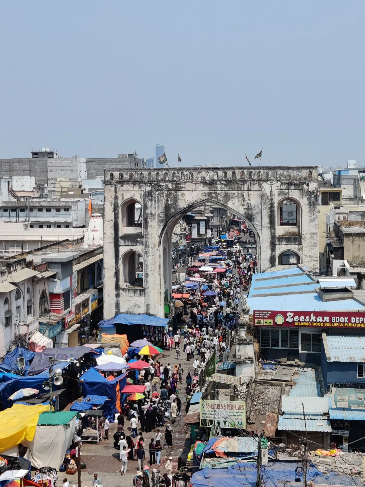
Machli Kaman is a small but distinctive arched gateway in Hyderabad’s old city, situated on the eastern approach to the Charminar precinct near Laad Bazaar. Literally “Fish Arch,” it marks the historic lane where fishmongers and vendors once clustered and still acts as a neighborhood landmark that frames daily market life. Its significance lies less in grandiosity than in being an urban memory: one of several kamaans (arches) that organize the radial street pattern around Charminar, helping define the dense market quarter and pedestrian routes into the historic core.
Architecturally the arch is modestly ornate in the Indo-Islamic vernacular of the Qutb Shahi/Asaf Jahi eras: a stuccoed masonry arch with small decorative panels and a central keystone often bearing a fish motif or local decorative painting, set amid tightly packed shopfronts and narrow lanes. The surrounding fabric — carved wooden balconies, lime-plastered walls, and signboards — gives context to the arch as an urban threshold rather than a standalone monument. Locally notable during festival times and market rushes, Machli Kaman is a fixed meeting point and photographic frame for street scenes; it also serves as a reminder of the old city’s trade specializations and enduring commercial rhythms.
Architecturally the arch is modestly ornate in the Indo-Islamic vernacular of the Qutb Shahi/Asaf Jahi eras: a stuccoed masonry arch with small decorative panels and a central keystone often bearing a fish motif or local decorative painting, set amid tightly packed shopfronts and narrow lanes. The surrounding fabric — carved wooden balconies, lime-plastered walls, and signboards — gives context to the arch as an urban threshold rather than a standalone monument. Locally notable during festival times and market rushes, Machli Kaman is a fixed meeting point and photographic frame for street scenes; it also serves as a reminder of the old city’s trade specializations and enduring commercial rhythms.
🗺 Map
Want to see more? Download the app. It's free!
- Weather informationCheck the forecast, clouds, rain, visibility, temperature, and wind before you go. Download it for free!
- How to get there?Choose how to get there by car, walking, or public transport from your location. Download it for free!
- CollectionsSave this spot in lists for future trips.
- Visited PlacesMark places you have visited and see them together on one map.
- Favourite RegionsGet alerts when new spots are added in your favourite regions.
- Offline mapsDownload maps before a trip for places with weak connection.
- Upload your photosUpload your photos and help other travelers find good photo spots.
- Audio guidesCreate narrated guides to listen to while you visit a place.