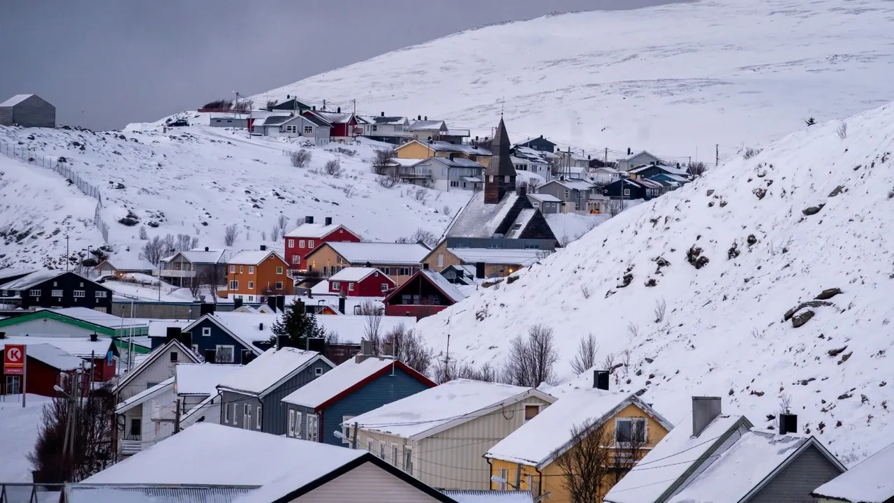
Havøysund is a compact Arctic fishing town on the island of Havøya in Måsøy municipality, northern Norway. It functions as a regional fishing port and service centre for coastal communities, notable for its working quay, fish-processing facilities and a landscape shaped by sea and wind. The town’s significance comes from its long maritime economy, Arctic location above the Polar Circle and dramatic views over the Barents Sea.
Historically Havøysund was largely destroyed during the German retreat in 1944 and reconstructed in the post‑war period, which explains its mid‑20th century layout and functional coastal architecture: simple wooden fishers’ houses, quayside sheds and processing plants oriented toward sheltering and servicing the fleet. A defining, unique feature nearby is the Havøygavlen wind farm and public viewpoint on Havøya’s highest ridge: turbines punctuate a panoramic, almost lunar shoreline from which you can see sea-ice, seabird colonies and the northern lights in winter or the midnight sun in summer. Local curiosities include an active cod and king-crab fishery seasons that shape town activity and occasional sightings of sea eagles around the harbour. The island is joined to the mainland by a short bridge, reinforcing its role as a coastal hub.
Historically Havøysund was largely destroyed during the German retreat in 1944 and reconstructed in the post‑war period, which explains its mid‑20th century layout and functional coastal architecture: simple wooden fishers’ houses, quayside sheds and processing plants oriented toward sheltering and servicing the fleet. A defining, unique feature nearby is the Havøygavlen wind farm and public viewpoint on Havøya’s highest ridge: turbines punctuate a panoramic, almost lunar shoreline from which you can see sea-ice, seabird colonies and the northern lights in winter or the midnight sun in summer. Local curiosities include an active cod and king-crab fishery seasons that shape town activity and occasional sightings of sea eagles around the harbour. The island is joined to the mainland by a short bridge, reinforcing its role as a coastal hub.
🗺 Map
Want to see more? Download the app. It's free!
- Weather informationCheck the forecast, clouds, rain, visibility, temperature, and wind before you go. Download it for free!
- How to get there?Choose how to get there by car, walking, or public transport from your location. Download it for free!
- CollectionsSave this spot in lists for future trips.
- Visited PlacesMark places you have visited and see them together on one map.
- Favourite RegionsGet alerts when new spots are added in your favourite regions.
- Offline mapsDownload maps before a trip for places with weak connection.
- Upload your photosUpload your photos and help other travelers find good photo spots.
- Audio guidesCreate narrated guides to listen to while you visit a place.