U
@ttrapani - UnsplashChippewa River
📍 From Trail, United States
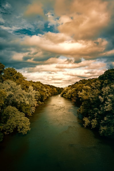
The Chippewa River is 95-mile long river flowing through beautiful landscape located in the Eau Claire area of United States. It is an excellent spot for a leisurely day of kayaking, paddling and fishing. There are multiple access points for putting in kayaks and canoes, including two popular natural scenic areas: Phoenix Park, by the confluence of the Eau Claire and Chippewa Rivers, and Lowes Creek County Park, which offers more than 25 miles of recreational trails, rustic camping and picnic areas, and boat launches. Along the way, visitors will find crystal-clear water, stunning natural beauty, and plenty of opportunity to spot wildlife. Photographers can capture scenic views and still life of the river’s rushing rapids and slow-moving pools, as well as surrounding flora and fauna.
🗺 Map
🎫 Tourist attractions
🌦 Weather information
Get weather information, and much more, from the app. Download it for free!
🚕 How to get there?
Get routes information (by car, walking, public transport, etc), and much more, from the app. Download it for free!