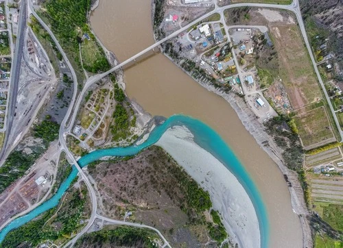
Cayoosh Creek is a stunning display of two rivers, the Harrison and the Fraser, coming together. Located on the Lillooet Indian Reservation, this site provides breathtaking views and is a popular spot for picnics and hikes. The surrounding rocks, trees, and clear blue water make for some of the most stunning photos in all of British Columbia. Dotted along the shorelines are numerous beaches and islands, wildlife, lush riparian vegetation and occasional waterfalls. Take in stunning sunrises and sunsets, look for wildlife and explore the rocky beaches. Whether you're a lover of nature or an amateur photographer, Cayoosh Creek is the perfect spot to capture some of British Columbia's finest scenery.
TOP
🗺 Map
🎫 Tourist attractions
🌦 Weather information
Get weather information, and much more, from the app. Download it for free!
🚕 How to get there?
Get routes information (by car, walking, public transport, etc), and much more, from the app. Download it for free!